What Is Virunga National Park? Geography, History, and Sectors
Virunga National Park covers approximately 7,800 square kilometers (3,000 square miles) across DR Congo’s North Kivu and Ituri provinces, making it roughly the size of Puerto Rico and, at nearly ten times the land area of Rwanda’s Volcanoes National Park, the single largest protected area anywhere in the Virunga Massif ecosystem. The park is not one uniform landscape but three distinct sectors strung along the country’s eastern border, each with its terrain, wildlife, and access route, which is a large part of why Virunga is described, accurately, as one of the most ecologically diverse single protected areas in Africa.
Three Sectors, One Park
| Sector |
Location |
Signature Features |
| Southern (Mikeno) |
Along the Rwanda border, around Mt. Mikeno, Nyiragongo & Nyamuragira |
Mountain gorilla trekking, Nyiragongo lava lake climb, Rumangabo Park HQ: the most-visited sector historically |
| Central |
Around Lake Edward and the Ishasha plains bordering Uganda |
Hippo pods, Nile crocodiles, savanna wildlife, boat safaris; adjoins Uganda’s Queen Elizabeth National Park |
| Northern |
The Rwenzori Mountains, on the Uganda border |
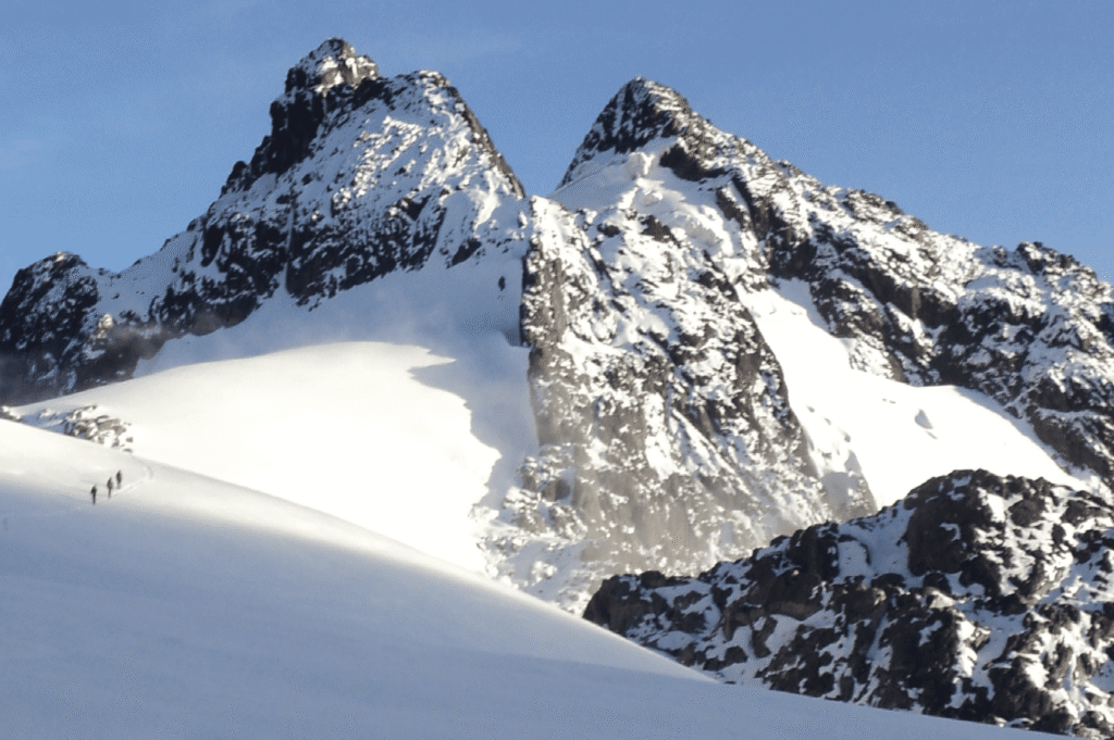
Glaciated equatorial peaks up to 5,109 m; remote, multi-day mountaineering terrain |
From Albert National Park to a UNESCO Site “In Danger”
Virunga’s origin story is one that most gorilla trekking content gets slightly wrong: the park was not founded as a Congolese park at all. In 1925, Belgian King Albert I established Albert National Park, a single protected area covering the Virunga volcanoes on both the Congolese and Rwandan sides of what was then the Belgian colonial territory, making it Africa’s first national park by a wide margin. When Congo gained independence in 1960, followed by Rwanda in 1962, the original park was split along the new international border: the Congolese portion became Virunga National Park, and the Rwandan portion became what is now Volcanoes National Park. The two parks you compare when planning a gorilla trek today were, for their first 35 years, literally the same protected landscape.
UNESCO inscribed Virunga as a World Heritage Site in 1979 and added it to the List of World Heritage in Danger in 1994, a status the park has now held for over three decades, longer than almost any other site on the list. The 1994 listing followed the Rwandan genocide, when more than a million refugees fleeing across the border settled in and around the park, driving deforestation, poaching, and the armed-group presence that continues to shape Virunga’s tourism access today. The park is managed by the Institut Congolais pour la Conservation de la Nature (ICCN), the Congolese government’s conservation authority, in partnership with the Virunga Foundation.
Mountain Gorilla Trekking in Virunga’s Mikeno Sector
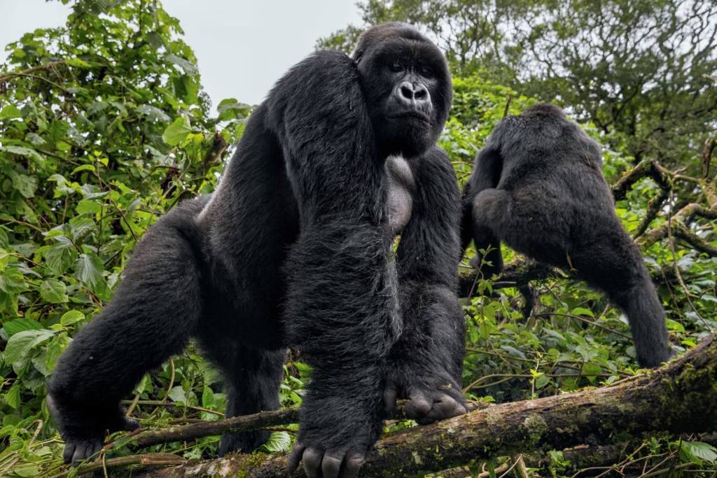
Virunga’s Mikeno sector, in the park’s extreme south along the Rwanda border, is DR Congo’s only destination for mountain gorilla trekking, and it has historically been the least expensive of the three countries where the subspecies can be trekked, with permits priced at roughly USD 400 per person against Uganda’s USD 800 and Rwanda’s USD 1,500. Gorilla tourism in Virunga dates to the 1980s, running from the Bukima and Kibumba patrol posts and the park’s Rumangabo headquarters, with visitors historically based at Mikeno Lodge, a small luxury tented camp overlooking the forest and, on clear days, Lake Kivu in the distance.
Virunga is currently home to more than a third of the world’s mountain gorilla population, according to the Virunga Foundation’s own published figures, concentrated in family groups that range across the slopes of Mount Mikeno. Historically, between eight and ten of these families were fully habituated and open to tourist visits, with names such as Kabirizi, Bageni, Rugendo, Mapuwa, Lulengo, Munyaga, Humba, and Nyakamwe, several of which trace their history to the same 1980s and 1990s habituation program that eventually inspired Rwanda’s much larger roster. What sets Virunga’s conservation story apart from Rwanda’s or Uganda’s is what has continued underneath the closures: even while the Mikeno sector has been off-limits to tourists, ICCN’s community trackers have kept monitoring the habituated families throughout, logging thirteen recorded gorilla births in Virunga since the start of 2026 alone, evidence that the population is still growing even in the absence of paying visitors.
The Senkwekwe Gorilla Orphanage
Adjacent to Rumangabo Park headquarters, the Senkwekwe Center is the only sanctuary in the world caring for orphaned mountain gorillas, since the subspecies cannot survive in captivity anywhere else and cannot be released back into the wild once orphaned. The center’s best-known resident was Ndakasi, rescued as an infant in 2007 after poachers killed her family group, raised for fourteen years by ranger André Bauma, and photographed in a widely shared 2019 image sitting upright beside two rangers in a pose that looked strikingly, movingly human. Ndakasi died at Senkwekwe in 2021, and her story remains one of the clearest illustrations of what Virunga’s rangers actually do day to day, work that continues regardless of whether the park is open to tourists.
How Virunga’s Gorilla Trekking Compares
| Country |
Park |
Permit Cost |
Habituated Families |
Status Today |
| Rwanda |
Volcanoes NP |
USD 1,500 |
24 |
Fully open, book 6–12 months ahead |
| Uganda |
Bwindi / Mgahinga |
USD 800 |
20+ (Bwindi) |
Fully open |
| DR Congo |
Virunga NP (Mikeno) |
~USD 400* |
8–10 (historical) |
Suspended confirm before booking |
Climbing Mount Nyiragongo: The Lava Lake Trek
Mount Nyiragongo, rising to roughly 3,470 meters directly above Goma, holds one of the only permanently active lava lakes on Earth, and the overnight hike to its crater rim is an experience with no real equivalent anywhere else in gorilla trekking country. Historically bookable as a separate permit from gorilla trekking, at roughly USD 300–400 per person, the climb has drawn adventure travellers who would otherwise have no reason to combine a volcano ascent with a primate trek on the same trip.
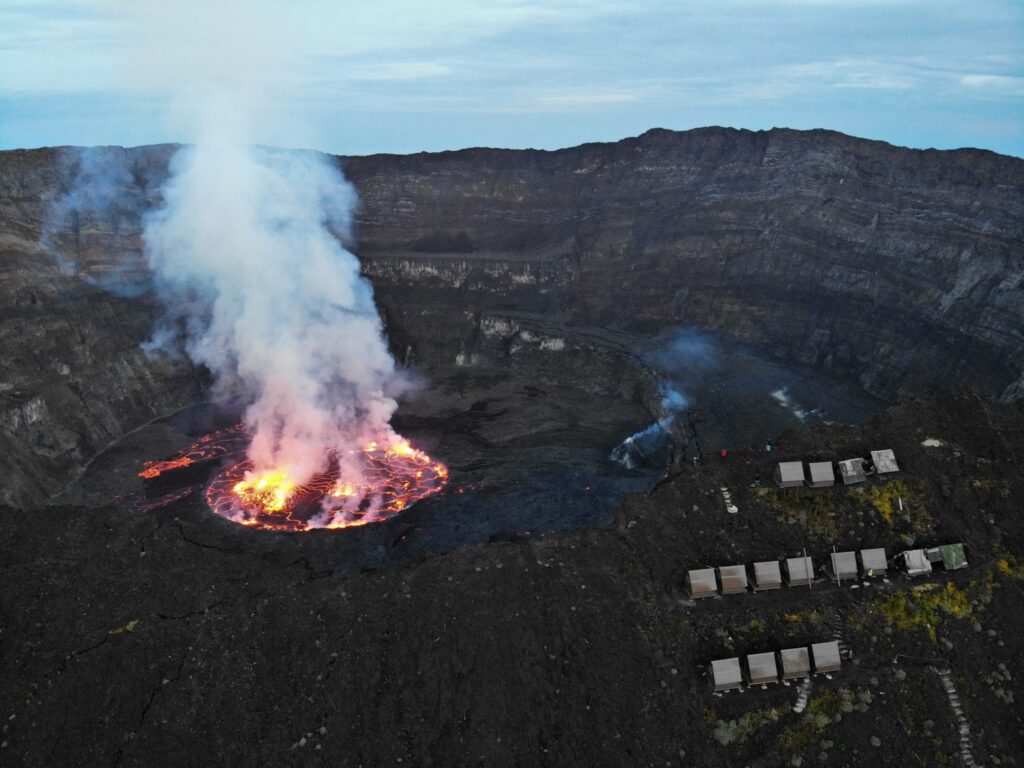
The ascent itself is a single, steep day-hike of five to six hours up loose volcanic scree, ending at a cluster of basic sleeping cabins perched directly on the crater rim at around 3,400 meters, close enough to the lava lake below that the glow is visible from the cabin doorways after dark and the heat is noticeably present in the night air despite the cold. Overnight temperatures at the rim regularly drop close to freezing, a detail easy to underestimate given Nyiragongo’s tropical latitude, and porters are available at the trailhead to carry gear for the ascent. Descent the following morning typically takes three to four hours. Nyiragongo’s neighbor, Nyamuragira, is Africa’s most active volcano by eruption frequency, but its remoteness and continual activity mean it is rarely, if ever, offered as a tourist climb; Nyiragongo is the volcano virtually all Virunga visitors mean when they ask about “the lava lake hike.”